Map Editor overview
Create and open maps, learn the viewport, camera controls, the View menu and the three edit modes, and how tiles and region cells lay out a Vastopia map.
9 min read
What the Map Editor is#
The Map Editor is where you build the places your players walk through. A map is a Terrain3D landscape plus everything standing on it: painted textures, elevated height layers, decorative props and painted scenery, interactive objects, NPC spawn points, named locations, trigger zones and walkability flags. Every map is saved as its own folder under assets/maps/<map_name>/, and saving also writes the server-side files the game server needs to path NPCs and players around it.
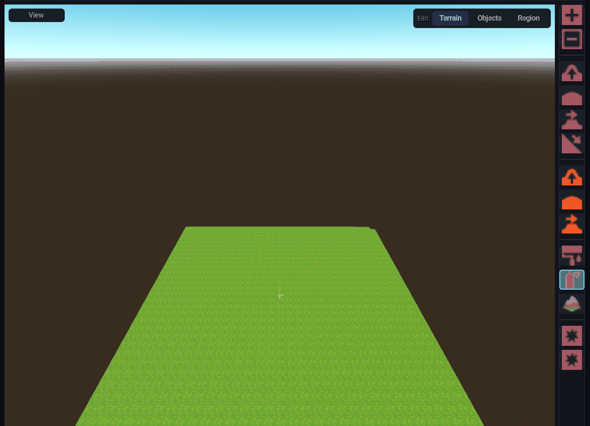
Open it from the mode bar with Map Editor (the Region Editor button also lands here, in Region mode). The workspace has four parts:
| Area | What it holds |
|---|---|
| Left panel | The Nodes tree for the open map (Terrain3D, WorldEnvironment, DirectionalLight3D) with an Inspector underneath, and the minimap |
| Viewport | The 3D view. The View button sits top-left; the Edit: mode toggle (Terrain, Objects, Region) sits top-right; a tool column runs down the right edge, between the view and the right panel; the tool settings bar sits along the bottom |
| Right panel | A context panel that follows the mode: Textures in Terrain mode, the model palette in Objects mode, and the region tabs (NPCs, Objects, Flags, Locations, Selection, Scene) in Region mode. A Library panel docks beneath it in Terrain and Objects modes |
| Map tabs | One tab per open map above the viewport, plus a + tab that returns to the map library |
Creating and opening maps#
The welcome screen#
With no map selected (or after clicking the + tab) the viewport shows the welcome screen: a Create New Map button, a Recent Maps list, and the full-width Map Library. The library shows every map in the project as a thumbnail tile, organized into folders you create with New Folder, with a Tiles / List view toggle. Select a map and press Open Map, double-click it, or right-click for Open, Rename, Duplicate, Share to Cloud and Delete. Create Map inside a library folder files the new map into that folder.
Up to five maps can be open at once. Each open map is its own tab; a map with unsaved changes shows * after its name, and closing it asks Save, Don't Save or Cancel.
Create a new map#
- Click Create New Map (or Create Map inside a library folder).
- Type a Map Name. The folder name is the lowercase name with spaces and punctuation replaced by
_; a name whose folder already exists is refused with a Name Taken dialog. - Choose a Map Type: Terrain (the normal outdoor map) or Dungeon (a flat cut-out floor you carve room by room; the generation rows disappear and the lighting switches to Dungeon).
- Set Regions (W x H), from 1 x 1 up to 8 x 8 region cells. The default is 2 x 2, centered on the origin.
- Pick a starting Terrain shape: Flat, Mountains or Island. The dice button rerolls the random seed; the Lighting Preview on the right shows the result before you commit.
- Drag a texture from the library onto Fill Texture (the base ground, slot 1) and optionally onto Autoshader (an overlay the terrain paints onto slopes and cliffs automatically). The fill defaults to the first library texture named "grass".
- Pick a Lighting Theme: Default, Sunset, Night, Overcast, Dawn or Dungeon. Any
.tresEnvironment you add with the + button is copied intoassets/lighting/and listed here too. - Press Create Map. The map is generated, saved immediately, and opens in a new tab. Island maps also turn the water plane on at the waterline.
Coordinates: tiles, world units and regions#
Vastopia maps are tile based. One tile is 0.5 world units on a side, and maps are centered on the origin, so negative tile coordinates are normal. Terrain is made of square region cells, each 64 x 64 tiles (32 world units). The standard 2 x 2 starter map therefore covers tiles -64..63 on both axes, the region cells (-1,-1) to (0,0).
Only active region cells exist: terrain, placements and walkability outside them are ignored by the game and the server. You grow a map by activating more cells with the Add Region tool in Terrain mode (or by sculpting with Add regions while sculpting on, which is the default). Region grid lines can be drawn over the ground with View Region Grid, and View Region Labels prints each cell's coordinates on it.
The project can cap how large a map may grow: Settings > Project > World holds a max world size in units per side. Saving a map that exceeds it still succeeds, but a World Size Exceeded dialog tells you which map spans too far.
Camera controls#
The viewport camera is an orbit camera. Keys are rebindable under Settings > Keybinds (the Camera group); these are the defaults.
| Action | Input |
|---|---|
| Fly forward / back / left / right | W / S / A / D |
| Move straight up / down | E / Q (while a placement tool is using them to rotate, they stop moving the camera) |
| Precise (slow) movement | Hold Shift while flying |
| Orbit around the view | Right-mouse drag |
| Pan | Middle-mouse drag |
| Zoom | Mouse wheel (or a trackpad pinch) |
| Adjust brush size instead of zooming | Shift + wheel |
| Adjust brush strength instead of zooming | Alt + wheel |
Keyboard flying pauses while you are typing in a text field and while Ctrl is held, so Ctrl+S and Ctrl+Z never nudge the camera. Speed, orbit sensitivity, pan speed and the two invert options live in Settings > Editor > Viewport:
| Setting | Default | Range |
|---|---|---|
| Zoom speed | 5 | 1 to 20 |
| Pan speed | 0.1 | 0.02 to 0.5 |
| Camera speed | 20 | 5 to 100 |
Slow camera speed (with Shift) | 5 | 1 to 30 |
| Orbit sensitivity | 0.003 | 0.001 to 0.01 |
| Invert orbit (vertical) | off | |
| Invert scroll zoom | off |
Perspective and top-down#
The View menu's first two entries are a radio pair: Perspective (default) and Orthogonal. Orthogonal locks the camera straight down into a top-down planning view at a fixed height; the wheel then changes the view size between 5 and 200 units, and right-mouse drag pans instead of orbiting.
The View menu#
The View button at the top-left of the viewport opens a checklist that stays open while you toggle items and closes when the mouse leaves it.
| Item | Default | Effect |
|---|---|---|
| Perspective / Orthogonal | Perspective | Camera projection (see above) |
| View Environment | on | Shows the map's WorldEnvironment and directional light; off renders with flat lighting |
| View Region Grid | off | Draws region cell lines on the terrain |
| View Region Labels | off | Prints region coordinates on each cell (editor only, never exported) |
| View Origin Point | on | A marker on tile (0,0) with short red +X and blue +Z axis lines |
| View Textures | on | Off replaces painted textures with a checkered grid so height reads clearly |
| View Information | off | Overlay with the cursor's world Position, its Tile, and live prop and mesh instance counts |
| View FPS | off | A large frame-rate readout: green at 50 and above, yellow at 30 and above, red below |
| View NPCs | on | NPC spawner markers |
| View Objects | on | Interactive objects |
| View Props | on | Individually placed props |
| View Meshes | on | Painted (batched) scenery |
| View Flags | on | Walkability flag overlay |
| View Locations | on | Location bounds |
| View Height Layers | off | Height layer wireframes (switched on automatically while a layer tool is armed) |
The three edit modes#
The Edit: toggle at the top-right of the viewport (default keys F1, F2, F3, group Edit Modes in Settings > Keybinds) switches what a click in the viewport does. Switching modes disarms whatever tool was live, then restores the tool that mode last had armed. Terrain and Objects start with nothing armed the first time you enter them; Region opens on Select Entity.
| Mode | What it owns | Tool column |
|---|---|---|
| Terrain | The ground itself: sculpting, texture painting, autoshader, holes, terrain regions, and the height layer brushes (tinted amber in the same column) | Terrain3D tools; the brush settings bar appears below the viewport |
| Objects | Everything with a model: Select, Area, Place (single props), Object (tile-snapped interactive objects), Building (stamp a saved prefab) and Paint (batched scenery) | The model palette on the right plus the Library beneath it |
| Region | Markers without a model: entity selection, NPC spawners, tile selection, walkability flags, locations and deletion | The region tool column replaces the Terrain3D one |
Read on for each mode: Terrain, Height layers, Props and model painting, Regions and elements and Building prefabs.
Saving and undo#
Ctrl+S (or the save button) saves the current map. A save writes the map folder and, when a project is open, the server extracts for that map; the full list of files is in Map files and export. Project > Save Project saves every open map.
Ctrl+Z / Ctrl+Y undo and redo per map tab. Terrain strokes are snapshotted per operation (the last 20 are kept), and placement, move, rotate, delete, batch, paste and building-stamp actions are all undoable. Height layer brush strokes are not in the undo history; see Height layers.
Other viewport shortcuts#
| Keys | Effect |
|---|---|
Delete | In Objects mode, deletes the current selection (an area, a prop, a painted batch or an object) |
Ctrl+C / Ctrl+V | Copy the selection; paste arms a ghost that drops on the next click |
Ctrl+X | Delete the tile selection in Region mode's tile-select tool |
Ctrl+A | Select every terrain tile while the Location tool is active |
Esc | Cancel a pending building stamp, paste or prop placement |
Q / E | Rotate the thing being placed (NPC spawners turn in 45 degree steps; props, objects, pastes and building stamps in 90 degree steps) |
1 to 9 | Select that terrain texture slot while a texture brush is armed |
| Letter keys | Pick terrain and object tools (see Keyboard shortcuts) |
With AI (MCP)#
Maps can be scaffolded and edited without the editor open. create_map writes an empty, editor-loadable map (default 128 tiles per side, centered on the origin, one height layer, water off); activate_map_regions grows it by region cell; list_maps and get_map_layout read what exists; set_starting_map makes a map the entry point; and show_in_editor / refresh_editor keep a running editor in sync. Terrain-specific tools are listed on the Terrain page.